~~~*Cracking the Eggs of All Known / Unknown Transformations Throughout All Creation*~~~ ####Finding and Discussing Breaking Headlines, Theories, Philosophies, & Discoveries#### ^As Well As Expositing Lost or Obscure Paradigms of Ancient Timelines. Namaste Starseeds^
Thursday, October 13, 2011
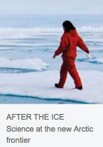
Redrawing The Arctic Map: The New North Getting To Grips With a Changing Polar Landscape <> Scientific Challenges in the Arctic: Open Water As the Ice Melts, Fresh Obstacles Confront Arctic Researchers
""The Arctic covers around 5% of the planet's surface, but it is capturing a disproportionate amount of attention. With temperatures rising at twice the global rate, the region's summer sea ice is shrinking rapidly, making access easier than ever before. At the same time, countries are racing to claim parts of the Arctic's sea floor and the vast deposits of hydrocarbons that lie beneath it.
Disappearing sea ice
Since satellite observations started in 1979, the September sea-ice extent has declined by 12% per decade, and the past 5 years have marked the lowest on record. The ice cover is thinning (see graph), making it more vulnerable to warmer temperatures. Forecasts by climate models (see graph) suggest that summer sea ice will largely disappear in the second half of the century, but the current rate of ice loss exceeds the models' forecasts, suggesting that ice-free conditions could arrive sooner.""
http://www.nature.com/news/2011/111012/full/478172a.html
""Last month, US researchers took a 4,000-tonne gamble when they steered the Marcus G. Langseth through the Bering Strait and into the Arctic Ocean. The 72-metre research vessel was not built to plow through ice, so it had never ventured that far poleward before.
But the rules are changing quickly in the new north. Managers at the US National Science Foundation (NSF), which owns the ship, decided to send the Langseth into the Arctic after reviewing satellite images that showed that the intended survey area in the Chukchi Sea had been largely clear of ice for four of the past five summers.
In an e-mail to Nature during the cruise, its principal investigator, Bernard Coakley, said: "We are rolling the dice a bit to take her up north." But the bet paid off for Coakley, a marine geologist at the University of Alaska Fairbanks. Sea-ice coverage was at near-record lows this summer, and the Langseth — due back in dock this week — has not encountered any troubling ice.
With the Arctic warming roughly twice as fast as the rest of the globe, there is more need than ever to monitor the changing conditions there. And the retreating summer sea ice is opening up new options for scientists who want to explore the once difficult-to-reach Arctic waters, allowing them, for example, to use vessels other than icebreakers.
But the scientists are not alone. Businesses, too, are racing to exploit the Arctic — for tourism, fishing, transportation and, especially, resources such as hydrocarbons. According to the US Geological Survey, the Arctic could hold up to 30% of the world's undiscovered gas and as much as 13% of its undiscovered oil1.
Governments keen to access this wealth are stepping up their activities in the area as a prelude to claiming rights to resources in vast swathes of territory under the United Nations Convention on the Law of the Sea (UNCLOS). When Russia planted a flag on the sea bed under the North Pole in 2007, many people saw the action as a symbolic statement about the country's territorial ambitions — a view bolstered this July when Russia pledged to station two brigades permanently in the Arctic. The next month, Canada launched its annual sovereignty operation in the Arctic and claimed that it now had more military capability in the region than ever before.""
http://www.nature.com/news/2011/111012/full/478174a.html
Labels:
Arctic,
Arctic Sea,
Bering Strait,
Changing,
Climate Models,
Forecasts,
Ice Melt,
Map,
Monitor,
New,
North,
North Pole,
NSF,
Open Water,
Redrawing,
Researchers,
Satellite,
Sea Ice,
USGS
Subscribe to:
Post Comments (Atom)


No comments:
Post a Comment